Lincoln National Forest Begins Hazard Tree Mitigation
Phase 1 Hazard Tree Mitigation Begins in the Blue 2 and South Fork Burned Areas Post Fire Recovery Work Breaks Ground on the Smokey Bear Ranger District

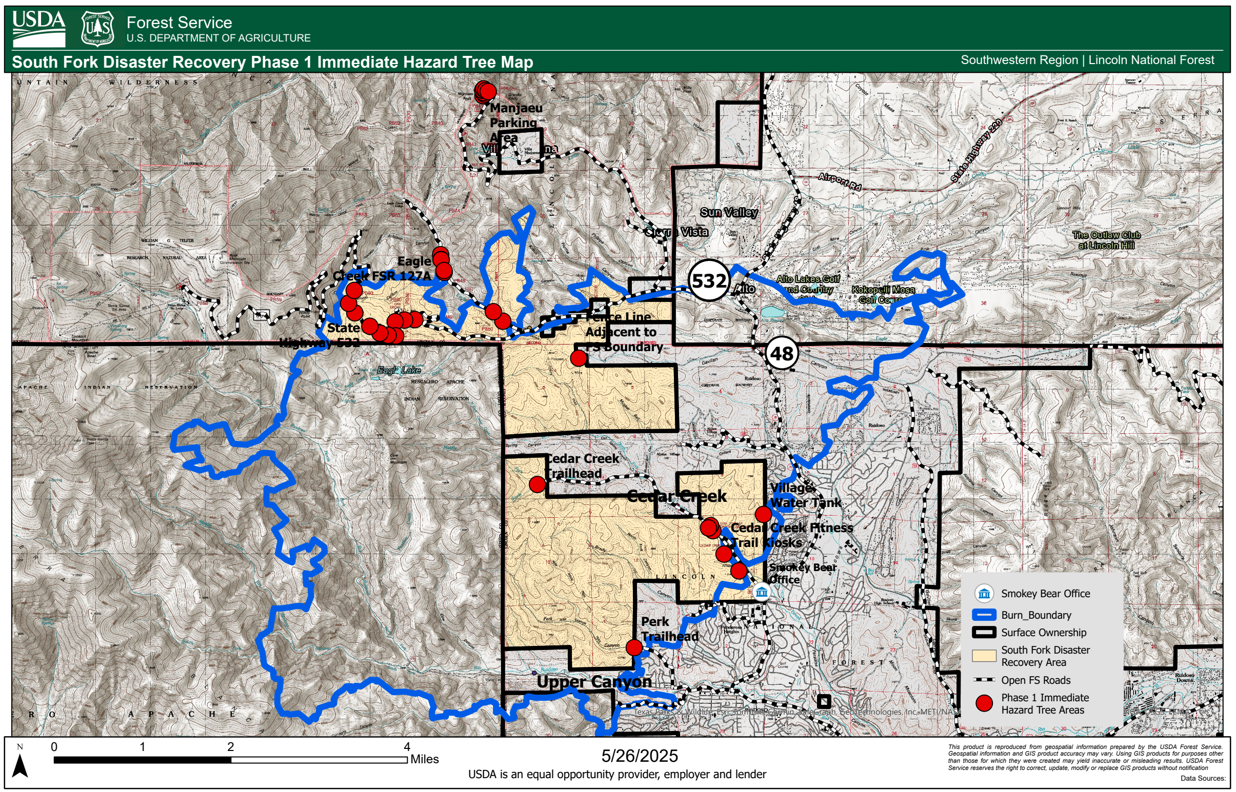
Crews have begun Phase 1 hazard tree mitigation in the Blue 2 and South Fork burned areas of Lincoln National Forest, starting October 10. This critical post-fire recovery effort focuses on high-use areas to enhance public safety and protect Forest Service and adjacent landowner property within the burn scars. Hazard tree mitigation focuses on cutting down standing dead trees that pose an impending danger of falling near major roads, recreation sites (e.g., trailheads, picnic areas, etc.), infrastructure, and areas where the public may concentrate on public land managed by the Forest Service.
Key Project Actions:
Targeted felling of hazard trees along Forest Service property, rights-of-way, main roads, boundary fences, recreation areas, and trailheads.
Mitigation methods include cutting or felling; felled trees will remain in place until Phase 2 removal.
Work will occur only on USDA Forest Service lands when near property boundaries.
This project marks an important step in restoring safe access and preparing the landscape for long-term recovery.
For LNF news and updates, visit the LFN website, and follow on Facebook.
Document(s):