November 17, 2026 (RUIDOSO, NM) — The USDA Forest Service has completed hazard tree removal in the South Fork and Blue 2 Fire burn areas, removing more than 1,000 damaged or hazardous trees from recreation sites, major roads, parking areas, and other heavily used locations in Lincoln National Forest.
The work, conducted on the Smokey Bear Ranger District, is part of ongoing recovery efforts following the 2024 wildfires. Removing hazardous trees helps reduce safety risks and supports the eventual restoration of public access to affected forest areas.
Residents should note that while this phase of hazard tree removal is complete, hazardous fuels reduction work continues in Cedar Creek, where temporary public access restrictions remain in effect.
Fuelwood Collection Opportunities
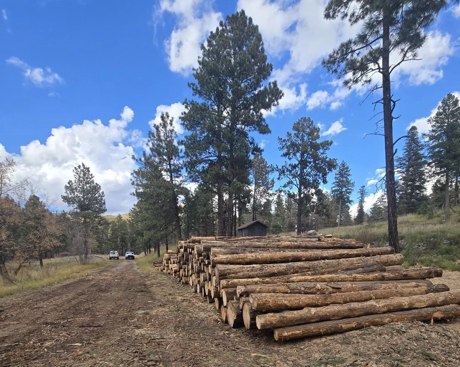
Stacks of removed hazard trees along a forest road at South Fork Campground, surrounded by tall pine trees in Lincoln National Forest, New Mexico.
The tree removal work has generated usable fuelwood that the Forest Service expects to make available for public collection.
The agency is working to establish safe collection opportunities within the affected areas. Residents must have a valid Forest Fuelwood Permit and should confirm designated collection locations before entering forest lands.
For permit information and collection updates:
Fuelwood permits: https://www.fs.usda.gov/r03/lincoln/permits/fuelwood-permits
Smokey Bear Ranger District: 575-257-4095
Cedar Creek Area Remains Closed During Forest Work
Separate hazardous fuels reduction operations are continuing in the Cedar Creek area near Ruidoso.
Forest Service crews and contractors are using heavy equipment to reduce hazardous vegetation and other combustible materials. The work is intended to lower future wildfire risks, improve public safety, and support long-term forest recovery.
Hazard trees removed from South Fork Campground as part of Lincoln National Forest's post-fire recovery efforts in the South Fork and Blue 2 Fire areas. USDA Forest Service photo.
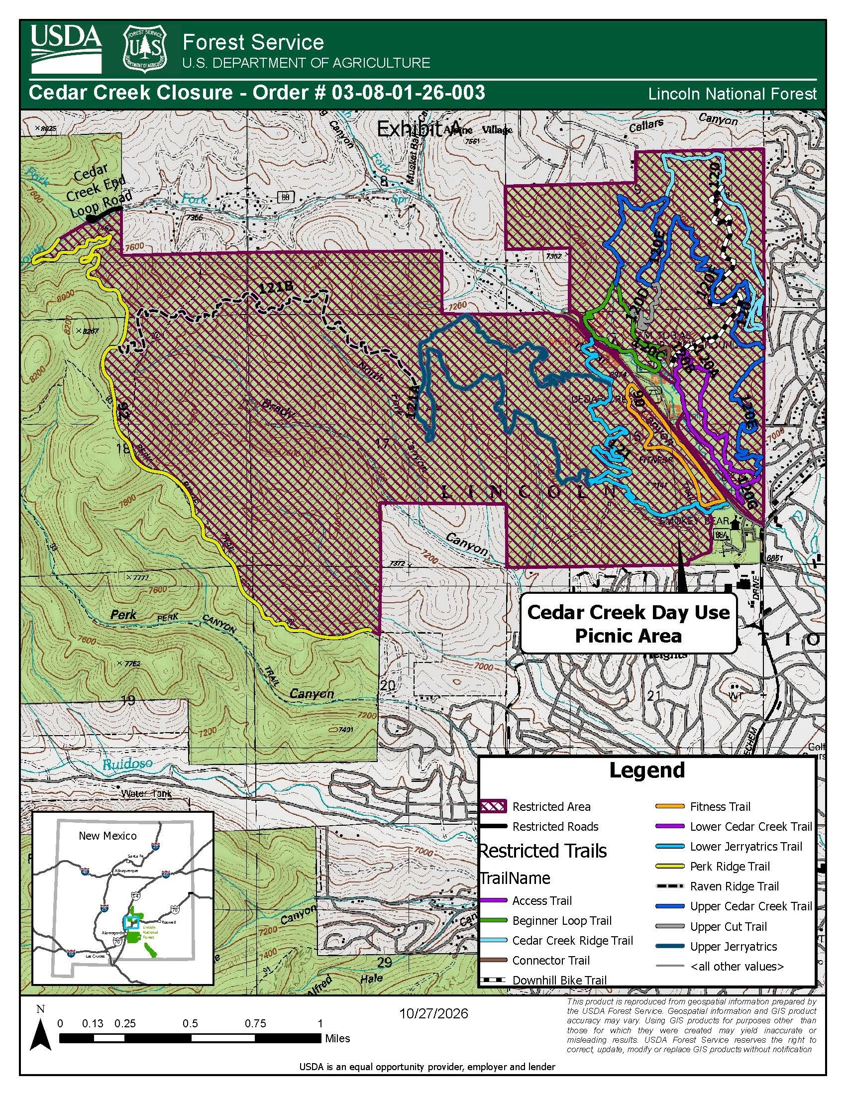
The Cedar Creek closure remains in effect. Residents and visitors should not enter restricted areas or use closed roads and trails while operations are underway.
Entering closed areas is prohibited and may result in citations or fines.
The Forest Service reports that crews are making progress and working to complete the treatments as quickly as conditions allow.
Residents can review the official closure boundaries and affected trails and roads using the Forest Service's Cedar Creek closure map.
Cedar Creek Closure Order No. 03-08-01-26-003:
https://www.fs.usda.gov/r03/lincoln/alerts/order-03-08-01-26-003-cedar-creek-closure
Stay Informed About Forest Conditions
Residents planning to visit Lincoln National Forest are encouraged to check current conditions, posted closures, and permit requirements before traveling into affected areas.
For additional information about forest recovery projects, recreation access, and public safety notices, visit:
Lincoln National Forest: https://www.fs.usda.gov/r03/lincoln
Information provided by the USDA Forest Service, Lincoln National Forest, November 17, 2026.